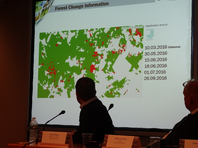
Dr. T. Haeusler presented at the ESA World Cover Symposium in ESRIN, Frascati on 14 March 2017 the main technical concepts of the deforestation/degradation mapping central to tropical humid and dry forest mapping which is being implemented within the EOMonDis project. In the presentation, he also emphasised that for the UNFCCC REDD+ policy process the importance of the user/stakeholder driven approaches to developing National Forest Monitoring Services and land use monitoring systems in terms of in-country capacity and ownership of the processes. This was emphasized in the context that whilst the global data sets such as the Global Forest Watch datasets have a value in supporting countries in the REDD+ Readiness Phase, the extent of utility is often mis-directed for users in developing countries (especially by the financiers/donors for REDD+). He noted that countries want ownership of not only the spatial data but the processes; this is also important when countries are ready to implement the results-based payments Phase of REDD+.
Dr. T. Haeusler made a presentation on EOMonDis at the World Bank Land & Poverty Conference in Washington, DC on 23 March 2017. As this forum was a wider non-technical audience from the World Bank and the counterpart developing countries the focus of the presentation was aimed more at the application of EO for addressing the policy and user requirements.